Before I begin, I need to say it’s just fun to say Atchafalaya. Say it aloud: Atchafalaya. Ah-CHAF-fuh-LIE-uh. Native American place names in the South, like Atchafalaya and Chattahoochee, are just as fun to say as Native American place names from the North, such as Winnipesaukee and Kinnickinnic.
The Atchafalaya River has been in the news as of late. The flooding in the Lower Mississippi River,
which I mentioned earlier last week, is slowly working its way downstream toward Baton Rouge and New Orleans. This flood is of epic proportions – levels this high have not been seen in the area since 1937.
The Atchafalaya is a distributary of the Mississippi. (A river distributary is the opposite of a tributary. A tributary is a river that feeds water into a main river; a distributary is a river that takes water from a main river, often in a river delta area.) Since the 1860s, the Atchafalaya has been growing, taking more and more water from the Mississippi and diverting it through central Louisiana to the Atchafalaya’s mouth south of Morgan City. In the mid-19th century the Atchafalaya took 10% of the Mississippi's water. Today, it's 30%.
The Army Corps of Engineers will alleviate some of the flooding in a similar, yet slightly different, manner to which they did upstream near Cairo, Illinois, a couple of weeks ago.
Upstream the Mississippi is penned in by a series of dikes which keeps flooding out of cities and farmland on either side of the river. The Corps blew up some of the dams on the Missouri side of the river to keep the river from topping the dikes around Cairo, effectively sacrificing farmland on the Missouri side to save the Illinois city of 3000 people.
 |
| Changing Mississippi River deltas over the past 5000 years |
In Louisiana, however, the problem is more complex. The Mississippi River has found several outlets in the Gulf of Mexico over the course of the last 5000 years through a wandering of its delta in a process known as
avulsion. Since the Mississippi lays down such a large amount of silt into the gulf, the river delta grows longer and shallower over time, with gravity coaxing the river to constantly search for newer, steeper, more efficient outlets to the sea. For most of the last century, the Army Corps of Engineers has been charged with the significant task of keeping one navigable channel via the Mississippi.
 |
| Old River Control Structure. Red line indicates the Atchafalaya Outflow Channel. |
Through a series of dikes and spillways, primarily at Old River Control Structure near Red River Landing and the Morganza Spillway near Morganza, the Corps has prevented the Mississippi from finding a more westward course. And, as long as the water levels stay low enough, it’s a difficult but possible feat. However, the Mississippi is a powerful force. With recent flow rates reaching 1.5 million cubic feet per second above Baton Rouge due to the flood, the Mississippi is an even more powerful force than normal.
(Check out this interactive map of both the Atchafalaya and Mississippi River systems in Louisiana showing where the river basins, spillway and dike systems, and diversions in the two river systems are located.)
Today the Corps opened the Morganza Spillway into the Atchafalaya. The reasons are twofold: first, the flood is high enough that the river would top the control structures even if they were not opened, which is dangerous; and second, Baton Rouge and New Orleans would be inundated without it. One news report stated that if the Morganza Spillway (just downstream from Old River) and the Bonnet Carre Spillway (just west of New Orleans) were not opened, that New Orleans could be swamped with over 20 feet of water. Memories of Hurricane Katrina come to mind.
The parts of the Atchafalaya basin that would flood are home to 25,000 people and 11,000 structures. The population in the basin was given several days' warning before opening. Even after opening the spillway, significant time would pass for the waters to reach the southern parts of the basin.
 |
| Travel times from when the spillway opens until when floodwaters reach an area |
The limited diversion into the Atchafalaya may save New Orleans in the short-run. But in nearly every article I’ve read, experts about the river for the past 150 years have repeatedly said that eventually the river will turn west, sooner or later, leaving a significantly smaller Mississippi to run through Baton Rouge and New Orleans -- and an economic devastation to the chemical and shipping industries there that rely on the river. The Corps is charged with not letting that happen. But nature makes a formidable adversary.
To learn more:
Louisiana Old River Control Structure and Mississippi River Flood Protection
Has some wonderful maps that show how the history of the control structure and how the levees work.
Flooding Scenarios for the Mississippi and Atchafalaya Basins
Three flooding scenarios run by the Army Corps of Engineers, released May 8, 2011. The first opening the Morganza Spillway 50%, the second by not opening Morganza Spillway, and the third by diverting water through the Old River Control System.
Atchafalaya
An article from New Yorker Magazine from 1987 that provides a rich history of the area and a look into the local perspective on controlling the river both in a current (1987) perspective and a historical perspective. It looks into the 1927, 1937, and 1973 floods, and what happened to the control process before and after these floods.
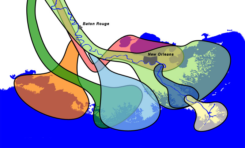
Interactive South Louisiana Map
The interactive map mentioned above showing the river basins, spillway and dike systems, and diversions in the two river systems are located.


